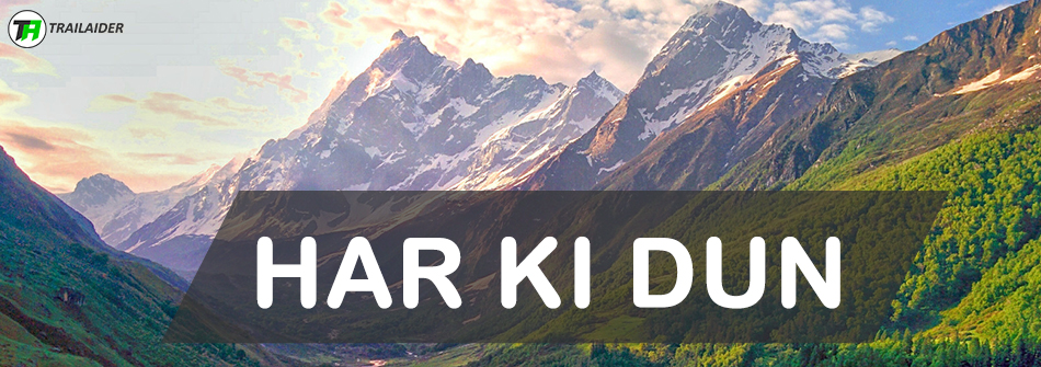
Lamkhaga Pass Trek, Best Indian Treks – Trailaider
The Lamkhaga Pass (5,280m or 17,318ft) is considered to be the most difficult crossover trek in the region. It takes you through the Kinnaur district of Himachal Pradesh to Harshil in Uttarakhand, located near the Indo-Tibetan border. The Lamkhaga Pass trek starts from Harshil and ends in Chitkul (last village of Sangla Valley in Himachal Pradesh) although it can be done from Chitkul to Harshil as well. This trek takes you on an adventure of a lifetime, from breathtaking views of alpine meadows to awe-inspiring mountain ranges, from dense alpine forests to pristine rivers.
The Lamkhaga Pass was first crossed by a Greek-British author and mountaineer Marco Alexander Pallis in 1933 also famous for his writings on Buddhism.
What to watch out for
Harshil
Harshil is a small town in the Uttarkashi district of Uttarakhand. It is a beautiful town situated on the banks of the Bhagirathi River. Wilson cottage which was built in 1864 is another highlight of Harshil. The pristine beauty of this place and the panoramic view of the surrounding mountains are to be seen to be believed.
Gangnani
Gangnani is an important scenic place for the fact that thousands of pilgrims take a dip in the holy water of Rishikund (natural hot springs). It is surrounded by the chilling glaciers of Himalayas.
Alpine Kyarkoti Meadow
You cross a dense deodar forest to enter this beautiful meadow. It offers some of the most breathtaking views of the surrounding mountain peaks. You can spot flocks of mountain sheep, langurs (monkeys), ibex (wild goats) and even foxes with some luck.
View from the Lamkhaga Pass
The view from the pass is the highlight of this trek. It offers a 360-degree view of the Kinner-Kailash range. One can only fell secluded from the rest of the world from the top.
Chitkul
Chitkul is the last village of Baspa Valley in Himachal Pradesh situated on the bank of Baspa River. A visit to the temple of Goddess Mathi is a must which is believed to have been constructed some 500 years ago.
Other Highlights Worth Mentioning:
Magnificent view of Shrikhand Mahadev and 2 other passes; Dhudiyan Pass and Chhotkhaga pass of Jalandhari Gad Valley.
- Kyarkoti Lake
- Ranikhanda meadows
- Baspa Glacier zone and glacial lakes
- Baspa Glacier Snout
- Baspa River famously known for its freshwater Trout fish
Why Lamkhaga Pass trek
The Lamkhaga Pass trek takes you on an altitude of more than 17,000ft. The major highlight of this trek is the fact that it not only takes you through the remotest villages of the region but it takes you from one state to another. You see a variety of culture and tradition. You start in Uttarakhand and finish the trek in Himachal Pradesh.
The Lamkhaga Pass has now become the classic route from Kinnaur to Garhwal and vice-versa. It is also one of the hardest treks of the region surrounded by mountains towering above 6000 meters.
Important features about Lamkhaga Pass trek
- Altitude: 5,280m or 17,301ft
- Duration: 11 days
- Difficulty Level: Difficult
- Total Distance Covered: Approximately 110 km
- Best Time to visit: May-October (July and august are not preferred because of the Rains but it can be done)
- Base Camp: Harshil
- Who can do Lamkhaga Pass trek: It is recommended not to take children because of the remoteness, height and length of the trek. Help is not easily available on this trek. A person should be well experienced to take such a challenge although a person with an excellent fitness level and knowledge about what and whatnots of a trek can do this trek.
How to Reach
- By Air: Jolly Grant Airport in Dehradun is the closest airport from Harshil about 260 km away. Daily flights on regular intervals run to Dehradun from major cities like Delhi, Mumbai etc.
- By Railways: Haridwar Railway station is the closest to Harshil about 250 km away. It is well connected to Delhi.
- By Road: There are buses from ISBT Kashmere Gate and ISBT Anand Vihar in Delhi all day long to Haridwar. Tickets can also be booked online on respective state transport websites or from any booking website. One can also easily reach Harshil from Rishikesh (243 km away), Dehradun (217 km away), Barkot (122 km away) and Uttarkashi (75 km away).
Brief Description of the Lamkhaga Pass Trek Itinerary
- Day 1: Delhi to Rishikesh (1,220ft)
- Day 2: Drive from Rishikesh (1,220ft) to Uttarkashi (3,500ft)
- Day 3: Drive from Uttarkashi (3,500ft) to Harshil (7,860ft)
- Day 4: Harshil (7,860ft) to Kyarkoti (12,530ft)
- Day 5: Kyarkoti (12,530ft) to Lamkhaga Pass Base Camp (14,500ft)
- Day 6: Lamkhaga Pass Base Camp (14,500ft) to Gundar (14,480ft) via Lamkhaga Pass (17,318ft)
- Day 7: Gundar (14,480ft) to Dumti (13,300ft)
- Day 8: Dumti (13,300ft) to Rani Kanda (12,100ft)
- Day 9:Rani Kanda (12,100ft) to Chitkul (11,316ft)
- Day 10: Chitkul (11,316ft) to Shimla (7,465ft)
- Day 11: Shimla (7,465ft) to Delhi
Detailed Description of the Lamkhaga Pass Trek Itinerary
Day 1: Delhi to Rishikesh
- Distance: 250 km
- Time: 6 hours
Catch an overnight bus/train from Delhi. Buses run all day long from Delhi. You can also fly to Jolly Grant Airport in Dehradun and then take a taxi to reach Rishikesh. It is only 21kms from the airport.
Day 2: Rishikesh to Uttarkashi
- Altitude: Rishikesh (1,220ft) and Uttarkashi (3,500ft)
- Distance: 170 km
- Time: 7 hours
Reach Rishikesh early to catch the bus to Uttarkashi. The bus service is not frequent, till noon only, board and early bus so that you reach Uttarkashi by evening. Check-in and take a walk on the mesmerizing environment of Uttarkashi. Sit on the banks of Ganges and think about the journey ahead.
Day 3: Uttarkashi to Harshil
- Altitude: Uttarkashi (3,500ft) and Harshil (8,590ft)
- Distance: 75 km
- Time: 3 hours
Take a morning taxi to reach Harshil. Check-in at your hotel and relax for a few hours as the journey is little tiring. Explore this scenic place, walk alongside the Bhagirathi River. You can also visit ‘Mukhba’ village near Harshil where the idol of Ganga (Hindu River Goddess) is brought down from Gangotri after Diwali. It remains at the village throughout the winter when the pilgrimage remains snowbound and inaccessible.
NOTE: If you are going with an organization then the transportation from Rishikesh to Harshil will be provided by the organization and you may or may not spend a night in Uttarkashi. It depends on the organization how their itinerary is. This itinerary is for the person(s) going without an organization.
Day 4: Harshil to Kyarkoti
- Altitude: Harshil (7,860ft) and Kyarkoti (12,530ft)
- Distance: 14 km
- Time: 5-7 hours
- Water Sources: Enough water spots on the way
There are two routes to reach; directly from Harshil to Kyarkoti (14 km trek), another one via Gangnani which is approximately 25 km.
We start our expedition today on foot. Today journey is a long one taking us through the dense forest of deodar and pine trees to the magnificent views of Jalandhari Gad Valley. Most of today’s trek is through the forest until we reach Kyarkoti meadow. The route is well marked and traversed frequently by the local shepherds. You may encounter them while trekking.
Today’s trek is a mix of gradual to steep ascents and descents. We also need to more careful as we’re going to gain an altitude of more than 4,500ft which is not recommended.
Landmarks:
- Today’s trek is well traversed
- Once you enter the clearing you will find Bhojpatra trees
- Glacial lake at Lower Kyarkoti Meadow
Day 5: Kyarkoti to Lamkhaga Pass Base
- Altitude: Kyarkoti (12,530ft) and Lamkhaga Pass Base Camp (14,500ft)
- Distance: Approximately 15 km
- Time: 5-7 hours
- Water Sources: Plenty of water sources
We trek for about 2 hours on the left side of the river before we need to cross the river to come to the right for Lamkhaga Pass. This part of the trek is fairly easy. After crossing the river we start our gradual ascent through moraine and scree zone. After about a couple of hours of ascent, we come across another river that we need to cross to get to the final section. Walk up the ridge and a final ascent to reach Lamkhaga Pass base camp.
Breathtaking views of the glacier and the surrounding peaks are to be seen.
Stay overnight in tents.
Landmarks:
- Bridge to cross the river to come to the right side. Don’t go straight as it leads to another pass “Chhotkhaga Pass”.
- Another river crossing to reach the ridge section. Total 3 river crossing on this day.
Day 6: Lamkhaga Pass Base to Gundar via Lamkhaga Pass
- Altitude: Lamkhaga Pass Base Camp (14,500ft), Gundar (14,480ft) and Lamkhaga Pass (17,318ft)
- Distance: 14 km
- Time: 7-8 hours
- Water Sources: Fill at the campsite. Depending on the weather water sources can be found. After the Pass, you’ll find a few water sources.
Today’s trek is the toughest of all days. It is comparatively easier if there’s snow otherwise you have to reach pass through boulder zone which can be very knee tiring journey. We need to cross crevasses and the climb is fairly steep which may require the use of technical gear to reach the Lamkhaga Pass.
We try to reach the Pass as early as possible to enjoy the scenic beauty of this place. It is truly mesmerizing to see mountains towering above 6000m, 7000m. Standing on top of the Lamkhaga Pass one can only find himself in a tussle between his words and his thoughts.
We now descend to reach our Gundar meadow campsite in Kinnaur Valley which is about 5-6 km distance away from the Pass.
Landmarks
- The trail is well marked by stones.
Day 7: Gundar to Dumti
- Altitude: Gundar (14,480ft) and Dumti (13,300ft)
- Distance: 15 km
- Time: 5-6 hours
- Water Sources: Enough water sources
The trail is a mix of gradual ascents and descents. We start by following the trail on the right side of the river; we will cross a number of streams today to reach Dumti. We start early and cross streams as the water level will rise afternoon making it difficult to cross the stream afternoon. As we reach closer to Dumti the valley starts to widen and we come across a lot of camping grounds; Nitthal Thach, Suthi Thach etc.
In the evening explore the beautiful meadows of Gundar; visit Karu temple, the extraordinary views of the snow-capped mountains surrounding the meadow.
Landmarks
- After half an hour trek cross Nakdum River to come to the right side.
- Nitthal Thach ITBP camp.
- Karu temple; 2-3 km before reaching Dumti.
- Dumti ITBP camp.
Day 8: Dumti to Rani Kanda
- Altitude: Dumti (13,300ft) and Rani Kanda (12,100ft)
- Distance: 10 km
- Time: 5 hours
- Water Sources: Enough water sources on the way.
The trail today is an easy one along the left bank of the river. Mostly flat walk with a few gradual ascents and descents and later part on jeep trails. On the left side of the river, you can see the trail leading to Borasu Pass marked by Bhojpatra trees.
Landmarks
- The trail is well marked and traversed by the locals and the ITBP men.
- For the later part of the trek, follow the jeep trails till Rani Kanda ITBP camp.
Day 9: Rani Kanda to Chitkul
- Altitude: Rani Kanda (12,100ft) and Chitkul (11,316ft)
- Distance: 8 km
- Time: 4 hours
- Water Sources: Enough water sources on the trail.
Chitkul is the last and the highest village in the Baspa Valley. We follow the jeep trails from Rani Kanda to Chitkul; an easy trail, mostly flat and a few gradual descents. Today is also the most relaxed day of the expedition.
Landmarks
- Nagasti ITBP camp.
Day 10: Drive from Chitkul to Shimla
- Altitude: Chitkul (11,316ft) and Shimla (7,465ft)
- Distance: 244 km
- Time: 9 hours
Drive from Chitkul to Shimla is very scenic but a long and tiring journey. You reach Shimla by evening. From here you can either stay in Shimla or board a bus to Delhi. There are bus services available to Chandigarh and Delhi at regular intervals.
Day 11: Drive from Shimla to Delhi
- Distance: 345 km
- Time: 9 hours
This is the last day of the expedition where we bid goodbyes to each other and finish our expedition.
Fitness Requirements
The Lamkhaga Pass trek is a difficult trek requiring an excellent level of fitness to complete the trek without much difficulty.
A person should be able to carry 8-10 kg backpack without any difficulties, able to run 10 km in an hour on a gradual slope (15-30 degree angle) without breaks.
You can start by HIT (high-intensity training) 3 months prior to the trek. You can go swimming, cycling, dancing etc. Start lifting weights if you like, climb stairs instead of lifts and elevators. Start slowly with a steady increase in pace and intensity.
Practice Yoga and Asana. It helps you in regulating your breath on ascents and descents. It’ll also help you to keep calm under difficult situations.
Start preparing 3 months prior to the trek and practice every day.
What to take
In order to successfully complete the trek, make sure you have all the necessary clothing, equipment, protective gear, medical kit and permission(s) from the respective forest department(s).
Basic Gear:
- Backpack and rain cover (50-60l with good back support and overall balanced structure)
- Day Pack + rain cover
- 2 Trek Pole (1 is better, 2 are awesome)
- Head Torch
- 2 Water Bottles/Hydration Pack
Technical Gear:
- Rope
- Crampons/Micro-spikes
- Carabineers
- Harness
NOTE: You don’t need technical gear if going with an established organization. They will arrange everything.
Medical Kit: One Strip of each
- Paracetamol, Ibuprofen
- Diamox, Dexamethasone and Nifedipine (High Altitude must-have meds)
- Pain Relief Spray
- Cough and Cold Tablets
- Antibiotics (Azithromycine, levocitrizine etc)
- Crepe bandage, Bandages, gauze, band-aids, alcohol prep band (to clean your hands in case you operate on a wound)
- Wound closure strips
Stay Comfortable
- 2 T-Shirts (full sleeves, preferably quick-dry)
- 2 Trek Pants
- 1 Fleece
- 1 Down/Hollow fill Jacket
- Wind and Waterproof (jacket and pants)
- Thermal Inners (upper and lower)
- Poncho
- Waterproof and Warm Gloves
Steps are a must
- Trekking Shoes (waterproof, high ankle)
- Floaters/Flip-Flops (optional)
- 3 pair of cotton socks
- 2 pair of woollen socks
- Gaiters
- Anti-fungal powder
Cover your Head
- Sun Cap
- Woolen Cap
- Neck-Gaiters
- Sunglasses: U/V protected. If you wear spectacles- either use contact lenses or photo-chromatic glasses.
Personal Utilities
- Sunscreen cream (SPF 50+ or more)
- Hand sanitizer
- Toilet paper and paper soap
- Toothbrush, toothpaste, face wash, soap and shampoo
- Lip Balm
- Quick-dry towel
- Moisturizer
Permission
You need to get the inner line permit as this trek is near the border. If you are hiring a guide or an organization, they will take care of the permits. You only need to bring the necessary documents.
If not then, please go to the forest department and get the permits.
NOTE: It’s always a good choice to hire a guide if going alone or with friends without an organization. Weather can drastically change in the mountains. You need someone to show the way in such conditions.
You May Also Like