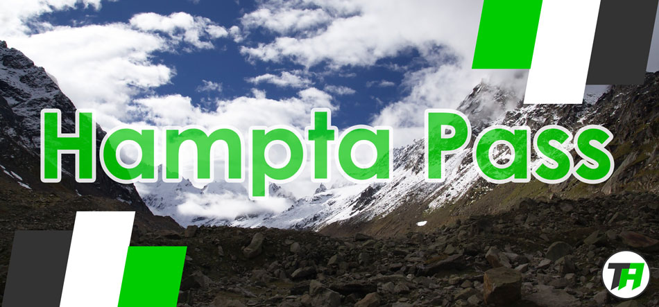
Hampta Pass Trek | Pir Panjal Range | Himalayas
Hampta Pass is one the most beautiful, pristine, awe-inspiring and dramatic crossover treks you can do in the Kullu region of Himachal Pradesh. The trek has derived its name from Hampta Village. It lies on the Pir Panjal range in the Himalayas. It is a small corridor between Lahaul’s Chandra Valley and Kullu valley of Himachal Pradesh. It offers breathtaking views of the two valleys.
You start from the lush green Kullu Valley and finish the trek in the desert Valley of Lahaul. From the top, you can witness the stark difference between the two valleys. This pass is frequently used by shepherds of the lower Himalayas, seeking high altitude grasslands in the summer, when the dry cold desert of Lahaul is barren. The variation in its trails is enormous; beautiful landscapes, open green pastures, meadows and glacial valleys.
What to watch out for
The Shea Goru Campsite
This is everyone’s ultimate favorite campsite. It’s an oasis in the desert settings of Lahaul Valley. A quiet stream flows near the campsite greening the area. You can spot wildflowers blooming near the stream plus a mighty view of the mountains surrounding the valley.
View from the Pass
The grandeur of the place cannot be described in words. You have to be there. In front of you lay the mighty Indrasen (20,410ft) and Deo Tibba (19,688ft) and below you on the other side are Lahaul Valley.
Chandrataal Lake
It comes with a bonus of a certain sense of seclusion which no other lake in Himachal Pradesh has. You can spend days exploring this area. The settings and contrast of the lake are breathtaking. It is on the Samudra Tapu plateau, which overlooks the Chandra River. It got its name from its crescent shape. It is at an altitude of about 14,100ft.
Important Features about Hampta Pass
- Altitude: 4200m or 14,100ft
- Duration: 5 Days
- Difficulty Level: Easy-Moderately Difficulty (depending upon the time of the year)
- Total Distance Covered: Approximately 26Kms trek
- Best Time to visit: May-Mid July and September-Mid November
- How to Reach: One can reach Manali by Air. Bhuntar is the nearest airport, 52kms away from Manali. Manali is also well connected to Delhi. Take an overnight bus from Delhi. Last bus leaves at around 8:30pm from ISBT Kashmere Gate. Tickets can also be booked online on respective state transport websites or from any booking website.
- Base Camp: Manali
- Minimum Age for the trek: 10-15 (depending upon the time of the year)
Brief Description of the Itinerary
- Day 1: Manali (6,700ft) to Chika (10,100ft) via Jobra (9,800ft)
- Day 2: Chika (10,100ft) to Balu ka Ghera (11,900ft)
- Day 3: Balu ka Ghera (11,900) to Shea Goru (12,900ft) via Hampta Pass (14,100ft)
- Day 4: Shea Goru (12,900ft) to Chhatru (11,000ft)). Drive to Chandrataal (14,100ft) and back to Chhatru (11,000ft)
- Day 5: Chhatru (11,000ft) to Manali (6,700ft) via Rohtang Pass (13,051ft)
NOTE: Chandrataal Lake can only be visited if the condition of the road and weather permits. It’s best to keep a day or two extra if you want to go to the Lake.
Detailed Description of the Itinerary
Day 1: Manali to Chika via Jobra
- Altitude: Manali (6700ft), Jobra (9,800ft) and Chika (10,100ft)
- Distance: Approximately 20kms drive and 2kms trekking
- Time: 4 hours
- Water Sources: Plenty of water sources nearby
The expedition starts from Manali to Jobra in a vehicle. You can hire a taxi from Prini as well. The drive takes about an hour to reach Jobra. From Jobra we start trekking, after trekking for 1-2 hours we reach out first campsite Chika.
The trekking starts from Allain Duhangan Hydro Power Project. The path takes you through the forest. You find Pine, Maple, Deodar, toss and oak trees on the trail. The trail is an easy one today. Once you leave the forest behind you will find a few sheep and cows grazing in the meadow. This is your first campsite Chika.
Landmarks:
- 20 minutes into the trek you will cross the Rani Nallah.
- Chika campsite is a vast spacious patch of green.
- Rani River flows in the middle of this place.
- There’s a Restaurant/Dhaba near the campsite.
Day 2: Chika to Balu ka Ghera
- Altitude: Chika (10,100ft) and Balu ka Ghera (11,900ft)
- Distance: 8.5kms
- Time: 5-7hours
- Water Sources: Enough water sources on the trail
Follow the left bank of the River which will appear on your right hand side after you cross the river. The initial trail is an easy gradual ascent which will lead you to a slope of boulders and rough terrain. You will come across beautiful dwarf
Rhododendron trees and silver birch trees on the trail. After crossing the trees you reach a waterfall on your left. The path is very narrow and slippery here. One needs to be very careful while crossing the waterfall. Fill your water bottles here.
After the waterfall, the trail leads toward the River to your left. You will have to cross the river to go to the other side. It’s best to reach early at the river crossing as the water level is much lower than it is in the afternoon. The water is icy cold and will definitely numb your feet. You will see snow-clad mountains and cattle grazing in the meadow after the crossing. The trail is now a flat walk and very picturesque. It is filled with multi-colored flowers.
You enter Jwara after finishing half day’s trek. It’s a beautifully serene, scenic valley. From here on the trail would be by the riverside. After an hour or so you will reach the end of the valley, which is the last part of Jwara. The trail is now covered with snow and rocks. The end of the trail is Balu ka Ghera. No one really knows why it is named that as it means “mound of sand” when it’s filled with green and snow. It is said that this place was formed by the river depositing sand and dust. Balu ka Ghera is a small flat ground amidst the mountains that you will need to cross next day to reach Hampta Pass.
Landmarks:
- 2-3 hours into trekking you will cross the waterfall on your left.
- An hour after the waterfall, you will reach a hut and a tea shop. Soon after it, you’ll need to cross the river.
NOTE: Start the day early. If you’re unable to reach Balu ka Ghera you can camp in Jwara. There are enough space and water sources in Jwara.
Day 3: Balu ka Ghera to Shea Goru
- Altitude: Balu ka Ghera (11,900ft) and Shea Goru (12,900ft)
- Distance: 7kms
- Time: Approximately 8 hours
- Water Sources: It is advisable to fill your water bottle at the campsite (also depends on the snow condition).
Today’s trek is the toughest. The first hour of the trek is gradual ascent followed by a steep ascent till the pass. The condition of the trail depends on the time you choose to visit. It stays full of snow in the early time of the year which is comparatively easier as in the later part you have to cross a lot of boulders and rough terrain to reach the pass.
We will also reach the highest altitude today at Hampta Pass (14,100ft).
The trail is along the riverside. An hour of gradual ascent will take you to the base of the mountain and then the final ascent to the pass begins. After crossing a couple of plateau’s you’ll reach the first ridge. Hampta Pass is only half an hour away from the first ridge. The ascent to the pass is a hard mount but once you’re at the top you can hardly feel the exhaustion. Mighty Indrasen and Deo Tibba lay in front of you.
The second half of today’s trek is the steep descent followed by a flat walk to reach Shea Goru. The descent is trickier than the ascent. You can’t even locate the bottom of the mountain. Depending on the season you will have to descent on rocks on slippery soil. It is tough on the knees. The descent will take around 2 hours to reach the bottom of the mountain. From the bottom trek to Shea Goru is an easy flat walk and will take a couple of hours to reach.
Landmarks:
- Ascent to the Pass is clearly visible from Balu ka Ghera. Mark your route and keep following it.
- Follow the open side of the valley from the bottom of the mountain after the descent. You will be on the left side of the river and you will feel like you’re leaving the mountains behind.
NOTE: Make sure you know the snow condition on the pass. If there’s too much snow it’s not possible to cross the pass and to reach Shea Goru without technical gear.
Day 4: Shea Goru to Chhatru. Drive to Chandrataal and back to Chhatru.
- Altitude: Shea Goru (12,900ft), Chhatru (11,000ft) and Chandrataal Lake (ft)
- Distance: 7kms and 45kms drive
- Time: 3-5 hours
- Water Sources: A few water sources on the way.
Today’s trek is the easiest of all days. The trail is an easy gradual descent. The trail can be compared to a scenic beach trek where you marvel at the beauty surrounding you. You cross the river and come to the right side of the river in the beginning only. There’s no green on the trail but it’s still pristine, you wonder why. Some part of today’s trek will lead you to edges of the mountains and ridges where one has to be cautious. Nevertheless, the trek is not that difficult as it sounds.
The last part of the trek is tricky where you have to cross a glacier. One needs either experience to cross it or crampons/micro-spikes because of the mighty Chandra River flowing below it. There’s hardly anything to break your fall in case you slip or fall. The other side of the glacier is the final campsite Chhatru. It’s a magnificent campsite straight out of a fairy tale, the consensus of three famous passes; Rohtang pass, Hampta pass and Spiti.
Chandrataal Lake:
The lake is about 45kms from Chhatru. It takes about 3-4 hours to reach Chandrataal Lake. You can hike up the magnificent Chandrataal Lake also known as “the moon lake”. The sheer blue color of the lake has a hypnotic effect on the surroundings as well as you. You can spend hours exploring the area; there are a few ponds as well here and there. You can visit Chandrataal Lake only in summers if the weather permits. It is only accessible for 3-4 months in a year and remains frozen and cut-off for the rest of the season.
Landmarks:
- After 3 hours of trekking you’ll reach a shepherds hut. From there gradually descend onto your left and cross the stream to reach the glacier.
- You’ll have to cross the bridge to reach the campsite. There’s a local restaurant (dhaba) there.
Day 5: Chhatru to Manali via Rohtang Pass
- Distance: 85kms
- Time: 5-7 hours (depends on the rush at Rohtang Pass and the road condition from Chhatru to Rohtang Pass. Sometimes trekkers have to spend hours in their vehicles because of the road conditions). It is advisable to keep a day extra.
Drive back to Manali via the famous Rohtang Pass. The route is very scenic; you won’t realize it until you reach Rohtang Pass.
Stay at the pass for some time, have a cup of tea and head towards Manali.
After 5-7 hours of the journey full of mellow reminisces of the hills, you will reach Manali in the evening.
Fitness Requirements for Hampta Pass Trek
Hampta Pass is an easy to moderate difficult trek. It requires a good level of fitness to complete the trek without much difficulty.
You can start by HIT (high-intensity training) 3 months prior to the trek. You can go swimming, cycling, dancing etc. Start lifting weights if you like, climb stairs instead of lifts and elevators. Start slowly with a steady increase in pace and intensity.
Practice Yoga and Asana. It helps you to regulating your breath on ascents and descents. It’ll also help you in keep calm under difficult situations.
What to take on Hampta Pass Trek
In order to successfully complete the trek, make sure you have all the necessary clothing, equipment, protective gear, medical kit and permission(s) from the respective forest department(s).
Basic Gear:
- Backpack and rain cover (50-60l with good back support and overall balanced structure)
- Day Pack + rain cover (for Chandrataal Lake)
- 2 Trek Pole (1 is better, 2 are awesome)
- Head Torch
- 2 Water Bottles/Hydration Pack
Medical Kit: One Strip of each
- Paracetamol, Ibuprofen
- Diamox, Dexamethasone and Nifedipine (High Altitude must-have meds)
- Pain Relief Spray
- Cough and Cold Tablets
- Antibiotics (Azithromycine, levocitrizine etc)
- Crepe bandage, Bandages, gauze, band-aids, alcohol prep band (to clean your hands in case you operate on a wound)
- Wound closure strips
Be Comfy on the Hampta Pass trek:
- 2 T-Shirts (full sleeves, preferably quick-dry)
- 2 Trek Pants
- 1 Fleece
- 1 Down/Hollow fill Jacket
- Wind and Waterproof (jacket and pants)
- Thermal Inners (upper and lower)
- Poncho
- Waterproof and Warm Gloves
Mind your Steps:
- Trekking Shoes (waterproof, high ankle)
- Floaters/Flip-Flops (optional)
- 3 pair of cotton socks
- 2 pair of woollen socks
- Gaiters
- Anti-fungal powder
Think about your Head:
- Sun Cap
- Woolen Cap
- Neck-Gaiters
- Sunglasses: U/V protected. If you wear spectacles- either use contact lenses or photochromatic glasses.
Personal Utilities:
- Sunscreen cream (SPF 50+ or more)
- Hand sanitizer
- Toilet paper and paper soap
- Toothbrush, toothpaste, face wash, soap and shampoo
- Lip Balm
- Quick-dry towel
- Hand sanitizer
- Moisturizer
Permission:
If going with an Organization: Organization will handle all the permits and vehicle permission on their own.
If going solo or with friends: In this case, you’ll have to either take the permission from Forest Department Kullu, SDM Office Manali or both.
- Kullu Forest Office Contact Info: 01902-222490
- SDM Office Manali Contact Info: 01902-254100/254200
You May Also Like
Mulkarkha Lake Trek – North East India Treks
Tiki Trail, Queenstown, New Zealand